The Poverty Mapping Portal shows the geography of poverty across Greater Manchester in maps. Its purpose is to offer a greater understanding of poverty across the city region.
Read the sections below to see how you can view the maps.
This Poverty Monitor is designed as a collection of indicators, which will be developed and updated to help monitor poverty over time. The maps in this part of the site help people drill down to their local areas.
It is designed as an ongoing resource, not a single-point-in-time report on poverty in Greater Manchester. It is designed to help people concerned about poverty to monitor the level of poverty, its distribution across the city, and the trends.
Select the 'Maps' link above and choose a map by clicking on the tree menu. Clicking on the right pointing arrow or 'double' clicking a menu item name will expand the tree. You can display a map layer by slecting the square box.
At the top right corner of the page this icon will take you to full screen mode. This icon will reload the whole page if you have a problem. This icon will explain how to print the maps.
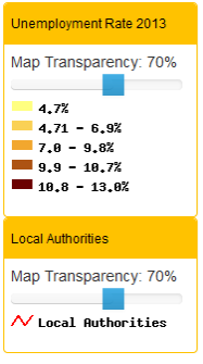 |
Once a map is turned on you can alter the 'transparency' level to see the different layers on top of each other. You can zoom in or out using the zoom bar from national to local levels. Use the magnifying glass to draw a box on the map to zoom in. Use the ‘hand’ to pan around the map. |
 |
Choose a map by navigating the tree menu. Click on the right pointing arrow or 'double' click a menu item name to expand the tree. Display a map by 'ticking' the square box next to where you see this symbol: 
The technical framework for the Poverty Map Portal has been developed by Richard Kingston.
The spatial data was collated and prepared by Brian Web (now at Cardiff University) and Moozhan Shakeri with policy advice from Cecilia Wong. We are all based in the Centre for Urban Policy Studies at The Universituy of Manchester.
Further details about what this portal does can be found under the Intro section.
Further details of this portal's developers can be found on the PPGIS site. Built using the
The Poverty Map Portal contains public sector information licensed under the Open Government Licence v2.0.
Full details can be found here: http://data.gov.uk/terms-and-conditions/
Contains adapted data from the Office for National Statistics licensed under the Open Government Licence v.2.0.
© Crown copyright and database right 2012
Contains Ordnance Survey data
© Crown copyright and database right 2012
Designed and developed by
The University of Manchester with the