The PPGIS Research Group @ Manchester carries out research & development on participatory decision support solutions for smarter cities.

Our aim is to enhance public involvement and participation in shaping the future of our cities and regions.
Our latest research funded by the ESRC is now avaiable @ commute-flow.net
More of our current projects are here.
You can find older project here.

submit to reddit  


Current work

We are working on a number of research projects at the moment, many of them live offering interactive mapping tools and others are still under development.

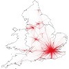
The ESRC funded commute-flow. Commute-flow forms part of the ESRC's Secondary Data Analysis Initiative programme which has developed an online toolkit for better planning of transport infrastructure.

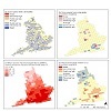
The Joseph Rowntree Foundation's ClimateJust. Climate Just is an information tool designed to help with the delivery of equitable responses to climate change at the local level.

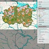
We are about to start work on an ESRC IAA funded project called MEMO. The MEMO project will work with stakeholders and citizens to develop a digital tool that shares knowledge by mapping the location of current GI projects, characterising the benefits they provide and identifying areas for innovation, improvement and interventions. The tool will aim to better communicate the benefits provided by GI, assist urban environmental planning and incentivise new GI projects. As this problem is by no means unique to Greater Manchester, it will be designed so that it is easily replicable in other city-regions.

Here you can find a demo project used mainly by our students using on-line GIS tool to support housing site allocations in Wakefield, W. Yorks.


Project archive

The Greater Manchester Poverty Index. The Poverty Mapping Portal shows the geography of poverty across Greater Manchester in maps. Its purpose is to offer a greater understanding of poverty across the city region.

Innovate UK and NERC funded Adaptation Planning Service. The Adaptation Planning Service Mapping Tools assists your organisation in adapting its buildings and infrastructure to climate change.

smart-ip was is a 2½ year project running from November 2010 funded by the European Commission's ICT Policy Support Programme. SMARTiP is focusing on the challenge of transforming public services by empowering 'smart citizens' who are able to use and co-produce innovative Internet-enabled services within emerging 'smart' cities. The project aims to take the experience developed by a wide range of existing user-driven, open innovation initiatives in Europe, particularly those developed through Living Labs, and to apply this experience to engaging citizens as active co-producers of public services. Our SMARTiP case study is here: The Green Home Watch.

EcoCities was a joint initiative between the University of Manchester and office provider Bruntwood, that seeks to provide a blueprint for the first climate change adaptation strategy for Greater Manchester.

Green and Blue Space Adaptation for Urban Areas and Eco Towns (GRaBS) was a 3 year project funded by the European Commission's INTERREG IVC program for €3m from 2008-2011. The GRaBS toolkit is on-line.

Joseph Rowntree Foundation Housing and Neighbourhood Monitor was a £1/4m project which ran from April 2008 - April 2011. Using a Google Maps interface different organisations were able to analyse and spatially map a range of data sets and use it in the support of neighbourhood analysis. The original web mapping site is now @ http://www.ppgis.manchester.ac.uk/hnm/.

SURegen - Integrated Decision Support System for Sustainable Urban Regeneration was £2.3m project over 4 years funded by the EPSRC Sustainable Urban Environments Research Programme

Citizenship in the Electronically Networked City was a PhD funded project by Jenni Cauvain (nee Viitanen), now a Leverhulme Fellow in Urban Sustainability at the University of Nottingham. The project was funded by an ESRC-CASE award with Manchester Digital Development Agency

NW England and N Wales Shoreline Management Plan PPGIS was a project working with the North West England and North Wales Coastal Group who were tasked with preparing a revised Shoreline Management Plan (SMP) for the coast between Great Orme's Head (N. Wales) and the Scottish Border. The SMP is the means by which the Coastal Group will determine the best way to look after the coast in a sustainable way for the next 100 years. It is prepared using guidelines set down by the Department for the Environment, Food and Rural Affairs which is the Government Department (under the previous Labour Government) having responsibility for setting national policy for defence of the coastline.

Woodland Planting demonstration of the potential for public participation in rural woodland policy making.

IntelCities was an EU funded research project investigating the delivery of public services in the future.

Virtual Slaithwaite was a major part of the ground-breaking ESRC Virtual Society? project from 1998. Arguably (according to others!) the first ever on-line PPGIS in a 'real' setting (unless you know of others?) in the world.

Nuclear Waste Disposal is based on the going work on using PPGIS for nuclear waster disposal in the UK (project based in Leeds).


Our publications

Most of these publication are available via ResearchGate

Journals

Viitanen, J. and Kingston, R. (2014) Smart cities and green growth: outsourcing democratic and environmental resilience to the global technology sector. Environment and Planning A, 46(4), 803 – 819, doi:10.1068/a46242.

Cavan, G. and Kingston, R. (2012) Development of a climate change vulnerability and risk assessment tool for urban areas. International Journal of Disaster Resilience in the Built Environment, 3(3).

Kingston, R. (2011) Tooling up for risk and vulnerability. Town and Country Planning, June, 262-266.

White, I., Kingston, R. and Barker, A. (2010) Participatory GIS for developing flood risk management policy options. Journal of Flood Risk Management. 3(4), 337-346. DOI:10.1111/j.1753-318X.2010.01083.x

Kingston, R. (2009) Conference report: Unequal Places: The 2009 UK-Ireland Planning Research Conference. Town Planning Review, 80(9), 647-654.

LeGates, R., Tate, N.J. and Kingston, R. (2009) Spatial Thinking and the Science of Spatial Planning. Editorial, Environment and Planning B: Planning and Design, 36(5), 763-768.

Ballas, D., Kingston, R., Stillwell, J. & Jin, J. (2007) Building a spatial microsimulation-based planning support system for local policy making. Environment and Planning A, 39(10), 2482-2499.

Kingston, R. (2007) Public participation in local policy decision-making: the role of web-based mapping. The Cartographic Journal, 44(2), 138-144.

Evans, A., Kingston, R. and Carver, S. (2004) Democratic input into the nuclear waste disposal problem: the influence of geographical data on decision making examined through a web-based GIS. Journal of Geographical Systems, 6(2), 117-132.

Carver, S., Evans, A., Kingston, R. (2004) Developing and testing a web-based GIS for teaching the principles of spatial decision-making. Journal of Geography in Higher Education, 28(3), 425 - 438.

Carver, S., Evans, A., Kingston, R. and Turton, I. (2001) Public participation, GIS and cyberdemocracy: evaluating on-line spatial decision support systems. Environment and Planning B: Planning and Design, 28(6), 907-921.

Kingston, R., Carver, S., Evans, A. and Turton, I. (2000) Web-Based Public Participation Geographical Information Systems: An Aid To Local Environmental Decision-Making. Computers, Environment and Urban Systems, 24(2), 109-125.

Carver, S., Evans, A., Kingston, R. and Turton, I. (2000) Accessing Geographical Information Systems over the World Wide Web: Improving public participation in environmental decision-making. Information, Infrastructure and Policy, 6(3), 157-170.

Kingston, R., Carver, S., Evans, A. and Turton, I. (2000) Net Gains. The Surveyor. 27th April, 187(5578).

Books

Kingston, R. (2014) Public Participation in Geocomputation. In Brunsdon, C. and Singleton, A. Geocomputation: A Practical Primer. London, Sage.

Kingston, R. (2011) On-line Public Participation GIS for Spatial Planning. In Nyerges, T., Couclelis, H. and McMaster, R. The SAGE Handbook of GIS and Society. London, SAGE Publications, pp.361-380

Kingston, R. (2010) Participatory Planning. In Warf, B. (ed) Encyclopedia of Geography. Thousand Oaks, CA: Sage.

Viitanen, J. and Kingston, R. (2009) The Role of Public Participation GIS in Local Service Delivery. In Reddick, C. (ed) Strategies for Local E-Government Adoption and Implementation: Comparative Studies. Hershey, PA: IGI Global, pp. 611-630.

Ballas, D., Kingston , R, Stillwell, J. and Birkin, B. (2004) Simulating the City. In Unsworth, R. and Stillwell, J. (eds) Twenty-first Century Leeds: geographies of a regional city. Leeds University Press.

Ballas, D, Kingston R and Stillwell, J (2004), Using a spatial microsimulation decision support system for policy scenario analysis, in J. van Leeuwen and H. Timmermans (eds.), Recent Advances in Design and Decision Support Systems in Architecture and Urban Planning, Dordrecht: Kluwer, pp. 177-192.

Kingston, R., Evans, A., and Carver, S. (2002) Public participation via on-line democracy. In Geertman, S. and Stillwell, J. (eds) Planning Support Systems in Practice. Springer-Valer.

Kingston, R. (2002) Web Based PPGIS in the UK. In W. Craig (ed.) Community Participation and Geographic Information Science. London: Taylor and Francis.

Other

LeGates, R. and Kingston, R. (2008) Improving GIScience in UK Spatial Planning Education. A Spatial Literacy in Teaching (SPLINT) White Paper, August. Available on-line. Accessed on 20th May 2009.


Our presentations

Presentations:

Invited talks:

(July 2013) What is a Smart City? #InterConnectIBM Conference , Manchester.

(November 2012) What is a Smart City and who does it benefit?, School of Architecture, Planning & Landscape, Newcastle-upon-Tyne.

(December 2011) A Planning Support System for adapting cities to climate change - The GRaBS Project. ICLEI - Local Governments for Sustainability, in partnership with the South African Department of Environmental Affairs (DEA), UN-Habitat and UN COP17 Climate Change talks, Durban, South Africa.

(January 2011) Do We Teach Planners the Most Appropriate GIS Knowledge? ESRI GeoDesign Summit. Redlands California.

(October 2010) Green and Blue Space Adaptation: a Planning Support System for Climate Change Vulnerability Assessment. School of Geography, Geology and the Environment Seminar Series, Kingston University

(November 2009) Who cares about Where[2.0] we are going? AGI Where[2.0] Conference, Harrogate.

(September 2009) Public Participation GIS: uses and warnings. University of York JISC Workshop - The Cultural Heritage of Historic European Cities and Public Participatory GIS.

(June 2009) Public Participation GIS: what it is, what it isn't & what you can use it for. AGI CPD Seminar Series, University of Manchester.

(December 2008) Building Community Involvement Toolkits for Engagement in Spatial Planning & Place Making. The Consultation Institute, Champions event: Annual Seminar, Henley Management College, Henley on Thames.

(February 2008) Is PPGIS Web2.0? School of Geography Seminar Series, University of Leicester.

(October 2007) Who are the public and what are they participating in?, World Universities Public Participation GIS Seminar Series.

(October 2007) Improving public participation through e-planning: a missed opportunity?, Bartlett School of Planning Seminar Series, University College London.

(November 2006) Recent Developments in PPGIS, guest seminar speaker, National Centre for Geocomputation, National University of Ireland at Maynooth, 28th November 2006.

(November 2006) Visualisation tools, ICT and participatory planning, Interreg IIIB Strategic Planning Action Network on Increasing Opportunities for Active Citizenship through Multi-level Governance and Strategic Territorial Planning. National Institute for Regional and Spatial Analysis, National University of Ireland at Maynooth, 29th November 2006.

(September 2006) The public, interactive maps and policy decision-making using PPGIS. British Cartographic Society Symposium, University of Manchester, 8th September 2006.

(July 2006) Intelligent Cities: developing new methods of public service management and delivery, ESRC Research Methods Festival, University of Oxford, England.

(May 2006) Recent Developments in PPGIS, UniGIS Guest Lecture, Manchester, UK.

Kingston, R. and Evans, A. (February 2002) Web-based GIS and Public Participation. Local Economy Policy Unit, South Bank University, UK.

(November 2000) Planning and Democracy on the Internet. RTPI's Planning Officer's Society Information Sub-group Workshop on E-Planning, Centre for the Magic Arts, London.

(April 1999) Information for Communities: web-based approaches to public participation. Deuchars Project, Inverness.

Conference papers, Workshops & Seminars

(September 2010) A Planning Support System for Climate Change Adaptation Action Planning. Royal Geographical Society with IBG, London.

(July 2010) Planning Support Systems - will they be applied more widely in a Web 2.0 world? AESOP, Helsinki, Finland.

(April 2010) Integrating Place-Making Skills in planning curricula: Spatial Analysis for Spatial Planning. Planning Academics Research Conference, Anglia Ruskin University.

(November 2009) Participatory GIS and public engagement in flood risk management. Cost Action C22 - Road Map Towards a Flood Resilient Urban Environment, Paris.

(April 2009) Sustainable Urban Regeneration - the role of a digital workbench. Planning Academics Research Conference, Newcastle University.

(April 2009) Participatory GIS for developing flood risk management policy options. Planning Academics Research Conference, Newcastle University.

(August 2007) What is the is the most appropriate conceptualisation of Public Participation GIS?, 45th Annual Conference of the Urban & Regional Information Systems Association, Washington DC.

(November 2006) The role of participatory e-Planning in the new English Local Planning System, Association of Collegiate Schools of Planning 47th Annual Conference, Fort Worth, Dallas, Texas.

(July 2005) Further Developments in PPGIS: initial thoughts on the E-City Platform. URISA PPGIS conference, Cleveland, Ohio.

(June 2005) 'Urban Regeneration in the Intelligent City' presented at the CUPUM '05 Conference at UCL in London.

(April 2005) Further developments in PPGIS: initial thoughts on the E-City Platform. Planning Research Conference, University of Manchester, England.

(July 2003) Building a Virtual Participatory Planning System for a Rural Community. URISA PPGIS conference, Portland, Oregon.

(July 2002) The role of e-government and public participation in the planning process. XVI AESOP Congress, Volos, Greece.

Kingston, R. and Turner, A. (September 2001) An Internet Tool For Forecasting Land Use Change And Land Degradation In The Mediterranean Region. 6th International Conference on GeoComputation, University of Queensland, Brisbane, Australia.

(October 2000) On-line Public Participation Geographical Information Systems. Border to Cross Meeting, Maastricht, Netherlands.

Kingston, R., Carver, S., Evans, A. and Turton, I. (October 1999) Virtual Decision Making in Spatial Planning: Web-based Geographical Information Systems For Public Participation In Environmental Decision Making Paper presented at the International Conference on Public Participation and Information Technology, Lisbon, Portugal.

Kingston, R., Carver, S., Evans, A. and Turton, I. (April 1999) A GIS For The Public: Enhancing Participation In Local Decision Making Paper presented at GISRUK'99, Southampton.

(October 1998) Web Based GIS for Public Participation Decision Making in the UK Paper presented at the NCGIA PPGIS Meeting, Santa Barbara, California. Other papers presented at the meeting are on-line at the NCGIA web site.

(October 1998) Accessing GIS over the Web: an aid to public participation in environmental decision-making. International Association of Public Participation (IAP2), Tempe, Arizona.

Kingston, R., Carver, S. and Turton, I. (April 1998) Accessing GIS over the Web: an aid to Public Participation in Environmental Decision Making Paper presented at GISRUK'98, Edinburgh, Scotland.

(April 1998) Accessing Geographical Information Systems over the World Wide Web: the use of technology to aid Public Participation in Environmental Decision-Making. 5th Annual Planning Academics Conference, Department of Town and Country Planning, University of Newcastle-upon-Tyne.


Contact us

Who are we?

We are based at The University of Manchester and we have been developing web-based decision support systems over the past 20 years.

The team is led by Richard Kingston's research into using GIS (Geographical Information Systems) as a tool to support decision making, the main objective of what we do is to provide your stakeholders with access to information and data in the form of on-line maps and visualisations. This then supports you in making better informed decisions about your location-based problems.

For further information please contact Richard Kingston either by e-mail or if you are trying to physically find where we are this Google Map may help. For more traditional methods you can use:

Richard Kingston, Department of Planning & Environmental Management, School of Environment & Development, Humanities Bridgeford Street Building, University of Manchester, Manchester, England, M13 9PL.   +44 (0)161 275 1936


Back to top Last updated: March 2017   |   Disclaimer   |   Privacy   |   Copyright notice   |   Accessibility   |   Freedom of information