The Climate Just Map Tool shows the geography of vulnerability to climate change at a neighbourhood scale. Its purpose is to support local planning and responses to a changing climate. The Tool includes the latest flood vulnerability and disadvantage data for the UK in addition to existing heat data for England.
New data and maps for April 2018.
The Climate Just Map Tool shows which places may be most disadvantaged through climate impacts. It aims to raise awareness about how social vulnerability combined with exposure to hazards, like flooding and heat, may lead to uneven impacts in different neighbourhoods, causing climate disadvantage. The maps can be used alongside other local knowledge to identify where actions may be needed. There are maps on:
- Flooding (river/coastal flooding and surface water flooding)
- Heat
- Fuel poverty.
All of these can help to inform local planning and responses to support vulnerable people and places.
The guidance presented here focuses on the flood and heat maps.
Read our brief overview to understand the key issues associated with climate disadvantage due to flooding and heat.
Read the in depth section for the reasons for mapping climate disadvantage, the concepts and indicators, the national picture and what can be done about it.
Before using the tool, look at the benefits and drawbacks associated with the maps.
To understand how to interpret the maps, drawing on examples from different local authorities, see the user guide.
To create your own maps using additional data, please refer to our technical guide.
- Select the ‘Maps’ tab above and choose a map by clicking on the tree menu. You can search for a key word in the map menu here too.
- Click on the right pointing arrow or 'double click' a menu item to expand the tree and find particular maps of interest.
- Select the square box to display a map.
- At the top right corner of the page this icon will take you to full screen mode. This icon will reload the whole page if you have a problem.
- When a map layer is displayed you can query specific
features by toggling the map query function on/off.


- To view two maps at the same time you will need to open the tool in two windows.
- Click here to download a printable version of the map layers available in the tool.
- Click here to download a printable version of the full set of information sheets which explain the key terms and indicators used.
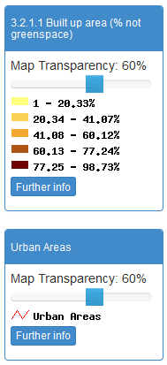 |
Once a map is turned on you can alter the 'transparency' level to see the different layers on top of each other. You can zoom in or out using the zoom bar from national to local levels. Use the magnifying glass to draw a box on the map to zoom in. Use the ‘hand’ to pan around the map. |
 |
- How you use the maps will depend on your task, for example, concerns over specific groups, such as older people, or issues, such as the built environment.
- Identify the issue of concern. If interested in flooding or heat, it is useful to begin by reviewing the maps of flood or heat disadvantage.
- Remind yourself about the key concepts, or look at more detailed guidance to understand which places are climate disadvantaged.
- Select a place of interest using the displaying maps guidance. Look at the drivers of disadvantage in that area by examining social vulnerability maps for the same topic.
- Understand the related drivers of social vulnerability by building up a picture of the drivers of concern. This can be supporting by looking at the individual maps under the headings of:
- Characteristics of social flood vulnerability, i.e. susceptibility, ability to prepare, ability to respond, ability to recover and community support, followed by the compound indicators and their supporting variables.
- Dimensions and indicators of social vulnerability heat, including:
- Sensitivity for personal factors
- Enhanced exposure for built environment factors
- Ability to prepare/ respond or recover for factors linked to people’s adaptive capacity.
- Use the maps to build up a local profile of the issues as a basis for identifying and discussing potential local responses with relevant stakeholders.
- Consider both the profiles of local areas and potential issues for action. Which areas or issues are priorities? How does this relate to existing local knowledge? How can the maps be used alongside local knowledge to inform action?
- Work with partners to develop a list of actions which can be taken now and longer term. See our adaptation planning section for further advice.
- Have a look at the user guide [pdf download] to interpreting the maps for examples of local flood and heat maps. This should help you to understand and interpret your local picture.
- Examine the maps of your local area. Are there areas of extreme flood or heat disadvantage?
- Examine the drivers of this – is it about high exposure, high vulnerability or both? Which indicators make the area most vulnerable?
- What does this suggest about the vulnerable groups and areas which you need to target in order to build resilience?
- A downloadable spreadsheet of area values to assist you with this task can be found via the Data download tab. Local authority summaries will be available soon.
- What do the maps suggest about issues to be tackled? Who else needs to be involved? Use the evidence on our website to help you consider issues for different vulnerable groups and how to develop local resilience.
- Evaluate your local area profiles. To what extent do you agree with these? What is missing and what might be supplemented with local datasets? Can finer scale representations be generated for some indicators? Check back on the map benefits and limitations to help with this task.
- Work with partners to develop responses.
Download a printable version of the map layers available in the tool.
There's also a printable version of the full set of information sheets.
The full data sets are available as Excel files and GIS shapefiles in the Data download area.
Choose a map by navigating the tree menu. Click on the right pointing
arrow or 'double' click a menu item name to expand the tree. Display a
map by 'ticking' the square box next to where you see this symbol:  .
.
Where you see this symbol  the corresponding map is an
index or composite indicator.
the corresponding map is an
index or composite indicator.
Download a printable version of the map layers available in the tool. There's also a printable version of the full set of information sheets.
If you are looking for the maps from the previous ClimateJust website they can be found here .
Select the Maps link above and use the tree menu to choose what to map. |
||
|
Once a map is turned on you can alter the 'transparency' level to see the different layers on top of each other. You can zoom in or out using the zoom bar from national to local levels. Use the magnifying glass to draw a box on the map to zoom in. Use the ‘hand’ to pan around the map. |
|
 |
Once a map layer is turned on you can query specific polygons on the map by turning on this query tool. |
|
A single click will force a popup window to appear with the exact data value for that polygon or grid square. |
||
Only a few layers can be overlaid. The administrative boundaries can be overlaid alongside any maps. If looking at the flood maps, you can add any of the Environment Agency layers alongside other flood maps. To print the maps you need to use the print screen option. To download the maps you can use the snipping tool which can be accessed through computer main menus to select areas of interest and export them to other documents. |
||
Climate Just Map Tool includes maps on:
- Flooding (river/coastal and surface water)
- Heat
- Fuel poverty.
Revised flooding data for the UK are based on work carried out by Sayers and Partners LLP for the Joseph Rowntree Foundation. The Neighbourhood Flood Vulnerability Index (NFVI) and Social Flood Risk Index (SFRI) are part of a wider piece of research reported in Sayers, P.B., Horritt, M., Penning Rowsell, E., and Fieth, J. (2017). Present and future flood vulnerability, risk and disadvantage: A UK scale assessment. The measures are explained elsewhere in the resource. See the copyright section for important information about usage restrictions and required acknowledgements for the data on this site.
The heat analysis for England is based on an assessment of social vulnerability in 2011 carried out by the University of Manchester. This has been combined with national datasets on exposure to flooding, using Environment Agency data, and exposure to heat, using UKCP09 data.
The work was led by Sarah Lindley at the University of Manchester and funded by the Joseph Rowntree Foundation (JRF), with support from the Environment Agency.
The work uses a methodology developed by Sarah Lindley and John O’Neill and published in a JRF report, Lindley, S. J., O'Neill, J., Kandeh, J., Lawson, N., Christian, R. and O'Neill., M (2011) Climate change, justice and vulnerability, Joseph Rowntree Foundation.
All map data themes for 2011 were developed by Aleksandra Kazmierczak, assisted by Caitlin Robinson, both at the University of Manchester.
The fuel poverty maps presented here are based on statistics from the Department of Energy and Climate Change. They cover both the new low income high cost definition of fuel poverty and 10% definition. These maps have been produced by the Centre for Sustainable Energy.
The Climate Just Map Tool itself has been developed by Richard Kingston. It is based on research developed as part of the Interreg funded GRaBS project which ran from 2008-11.
We also gratefully acknowledge all data providers and stakeholders who provided valuable feedback at various workshops. Particular thanks to members of the Project Advisory Group who have supported the development of Climate Just.
We would particularly like the acknowledge the EA, SEPA and Natural Resources Wales who provide data under the 'Government Agency Flood Maps' section of this site under OGL.
Further details about the purpose of the map tool can be found in the 'Intro' section.
Further details about its developers can be found on the PPGIS site.
The data that powers the maps is available for download in Excel format or as a shapefile.
Shapefile formatIf you have your own GIS software such as ArcGIS, MapInfo or the free QGIS software you can view and analyse the following shapefiles yourself
- Neighbourhood Flood Vulnerability Index (NFVI) and Social Flood Risk Index (SFRI) data [281 mbs]
- Socio-spatial climate vulnerability indicators [46.8 mbs]
- Socio-spatial climate vulnerability indices [11.2 mbs]
If you do not have your own copy of the administrative boundaries you can download them from ONS's Open Geography Portal .
Excel Format
The attribute data is also available in individual Excel files
- Neighbourhood Flood Vulnerability Index (NFVI) and Social Flood Risk Index (SFRI) data [27.3 mbs]
- LA summaries vulnerability disadvantage - available soon.
- Socio-spatial climate vulnerability indicators [8.61 mbs]
- Socio-spatial climate vulnerability indices [0.9 mbs]
When using this data we highly recommend that you refer to our technical guide. It explains how to create your own maps, using data from this Climate Just website and map tool, in your own GIS system.
The Climate Just tool contains public sector information licensed under the Open Government Licence
Full details can be found here: http://data.gov.uk/terms-and-conditions/
Contains derived data from the Office for National Statistics licensed
under the Open Government Licence.
© Crown copyright and database right 2012
Contains Ordnance Survey data
© Crown copyright and database right 2012
The Neighbourhood Flood Vulnerability Index (NFVI) and Social Flood Risk Index (SFRI)
This data remain the IPR of Sayers and Partners LLP but are provided free of charge for non-commercial use within the Climate Just website.
This excludes commercial use of the data (selling or reselling the data directly or within derived products, or for paid research or consultancy).
The origin and IPR of the data (specifically the NFVI and SFRI) should be clearly acknowledged as from Sayers and Partners 'Sayers, P.B., Horritt, M., Penning Rowsell, E., and Fieth, J. (2017). Present and future flood vulnerability, risk and disadvantage: A UK scale assessment. A report for the Joseph Rowntree Foundation published by Sayers and Partners LLP.'

The socio-spatial heat vulnerability Index and heat disadvantage data
These data remain the IPR of the University of Manchester but are provided free of charge for non-commercial use within the Climate Just website and via the associated download.
This excludes commercial use of the data (selling or reselling the data directly or within derived products, or for paid research or consultancy).
The origin and IPR of the data should be clearly acknowledged as from Lindley, S. J., O’Neill, J., Kandeh, J., Lawson, N., Christian, R. & O’Neill M. (2011) "Climate change, justice and vulnerability", Joseph Rowntree Foundation Report, York http://www.jrf.org.uk/publications/climate-change-justice-and-vulnerability.
Further data acknowledgements should be made according to item 2 above. Furthermore, the heat disadvantage data are derived from UKCP09 data and any use should also carry the acknowledgement below.
Data Acknowledgement: UKCP09 © Crown Copyright 2009. The UK Climate Projections (UKCP09) have been made available by the Department for Environment, Food and Rural Affairs (Defra) and the Department of Energy and Climate Change (DECC) under licence from the Met Office, UKCIP, British Atmospheric Data Centre, Newcastle University, University of East Anglia, Environment Agency, Tyndall Centre and Proudman Oceanographic Laboratory. These organisations give no warranties, express or implied, as to the accuracy of the UKCP09 and do not accept any liability for loss or damage, which may arise from reliance upon the UKCP09 and any use of the UKCP09 is undertaken entirely at the users risk.
The supply of data in no way implies or leads to an expectation of support in the use of these data. No updates or modifications will necessarily be made available. The University of Manchester does not make any warranty as to the accuracy of these data and will accept no liability for any inaccuracies in the dataset. There is no liability accepted by the University of Manchester in relation to any issues or liabilities that may subsequent arise from use of the data for any purpose. A list of caveats and limitations is available via the ClimateJust map portal.
Designed and developed by
The University of Manchester with the