MEMO - Manchester's Environment Map: Online

Urban greenspace, or ‘green infrastructure’ (GI) provides vital socio-economic and environmental services in urban areas. This is a core aspect of recent and ongoing research within SEED as GI is now recognised as vital in the creation of sustainable and liveable cities.

However, strategic environmental planning1 is being hampered by key gaps in knowledge, including:
  • the location of existing GI projects and gaps in GI provision;
  • the types and concentration of benefits that GI is providing; and
  • the public’s opinions on how green spaces are used and valued at strategic scales.
Stakeholders from across Greater Manchester identified in an environmental forum (Green and Blue Infrastructure Group) that an online digital tool is needed to enable organisations and citizens to share knowledge about GI projects across the city region.

The MEMO project will work with stakeholders and citizens to develop a digital tool that shares knowledge by mapping the location of current GI projects, characterising the benefits they provide and identifying areas for innovation, improvement and interventions.

The tool will aim to better communicate the benefits provided by GI, assist urban environmental planning and incentivise new GI projects. As this problem is by no means unique to Greater Manchester, it will be designed so that it is easily replicable in other city-regions.
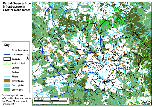
GI map

The project is being led by Prof Richard Kingston & Dr Anna Gilchrist in the Department of Planning & Environmental Management, School of Environment, Education & Development, University of Manchester and is funed by an ESRC Impact Acceleration Account.
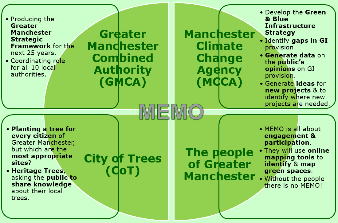

Project Aim

The aim is to develop an online mapping platform to share information on the location, benefits and public values of GI projects in Greater Manchester (GM), to facilitate strategic planning.

This will be delivered throu four objectives:

  • inform stakeholders about existing GI projects, the characteristics/benefits provided by successful schemes and identify gaps in GI provision;
  • create a platform for the exchange of information between stakeholders and citizens about GI projects;
  • increase understanding about the perceptions and opinions of GM citizens of GI provision within the city-region;
  • develop a rich dataset of GI projects and public perceptions that can be shared with other environmental stakeholders.


Methods - a PPGIS approach

Our approach builds on partnership working between the academic team and the project partners outlined to the right. Past research (Kingston, 20072, 20143) has shown that developing technical toolkits and decision support systems requires the engagement of stakeholders in developing the tools themselves. This ensures they are fit for purpose.

MEMO partners

Benefits

  • The University benefits from the project by developing stronger ties with the policy and user communities as outlined in the diagram below.
  • The project offers the research team an opportunity to work directly with all the key GI stakeholders across Greater Manchester.
  • It further strengthens user-driven research connections and offers a mutually beneficial relationship between the University and the project partners.
  • The partners benefit from the latest methods and technologies to improve public engagement and policy making.


Expected outputs, outcomes & impacts

Expected outputs:
  • Interactive online mapping toolkit.
  • Datasets of GI projects, public perceptions, opinions and feedback on GI provision for use by stakeholders and researchers.
  • Summary documents on the process and methods used to develop the GI mapping tool.
  • Two peer-reviewed journal papers.
  • Future proofing the tool for continued use beyond the project timeframe.
Expected outcomes:
  • Improved understanding of GI provision across GM.
  • Better public engagement in GI policy making.
  • More joined-up thinking around GI provision.
Expected impacts will be achieved in four key ways:
  • Developing an enduring, open source digital platform to inform GI planning.
  • Ensuring the methodology for developing the tool is easily replicable for use in other cities and locations. This transferability will be maximised by producing a ‘process and methods’ summary.
  • The production of a rich dataset that will be shared with relevant stakeholders across local authority, city region and national scales.
  • The IAA will test the feasibility of implementing a collaborative participatory online tool at Local Authority and city-region scales.


Contact us

Who are we?

We are based at The University of Manchester and we have been developing web-based decision support systems over the past 20 years.

The team is led by Richard Kingston's research into using GIS (Geographical Information Systems) as a tool to support decision making, the main objective of what we do is to provide your stakeholders with access to information and data in the form of on-line maps and visualisations. This then supports you in making better informed decisions about your location-based problems.

For further information please contact Richard Kingston either by e-mail or if you are trying to physically find where we are this Google Map may help. For more traditional methods you can use:

Richard Kingston, Department of Planning & Environmental Management, School of Environment & Development, Humanities Bridgeford Street Building, University of Manchester, Manchester, England, M13 9PL.   +44 (0)161 275 1936

References

1 Gilchrist, A., Barker, A. and Handley, J. (2015) Pathways through the Landscape in a Changing Climate: The Role of Landscape Structure in Facilitating Species Range Expansion through an Urbanised Region. Landscape Research.

2 Kingston, R. (2007) Public participation in local policy decision-making: the role of web-based mapping. The Cartographic Journal, 44(2), 138-144.

3 Kingston, R. (2014) Public Participation in Geocomputation. In Brunsdon, C. and Singleton, A. Geocomputation: A Practical Primer. London, Sage.


Back to top Last updated: March 2017   |   Disclaimer   |   Privacy   |   Copyright notice   |   Accessibility   |   Freedom of information